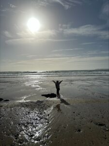
A Family Outing To Albion Sands
Albion Sands is a lovely golden sand beach backed by high red cliffs of Devonian sandstone and shale. It lies immediately north of Marloes sands and east of the long narrow Gateholm Island. The beach is accessible from Marloes car park, but requires walking in the opposite direction, past the Marloes Youth Hostel. Many years ago Albion Sands was a popular destination for our family with small children, as there was a rock pool near Gateholm Island, where the children liked to play especially on warm summer afternoons when the sun had warmed the water. I watched our eldest son make his first walking steps down the smooth sand of the beach there. The path that we used to descend to Albion Sands disappeared long ago when the cliff slipped away. But this year that same son went back there with his young son and partner to see if the pool was still there. It was full of sand, but he found that there is now a new track down the cliff to the beach. An alternative way is to stick to the coast path until nearest to Gateholm Island and then descend onto the rocky beach there and the walk around onto Albion Sands.
The Albion was one of the first and also a crack packet paddle steamer operating a service between Cork and Bristol for the Bristol General Steam Navigation Company. She held the speed record from Cork of only 22hours. On April 19th 1837 at 3.00.pm she was heading south from Dublin through Jack Sound (between the Dale Peninsula and Skomer Island – a famous tidal race) when she hit a submerged rock. This caused a severe leak and her captain was forced to run her ashore. Her cargo was composed of Irish dairy produce, livestock and passengers. A sloop rescued the 50 people comprising the passengers and crew. The 150 pigs and five horses were swum ashore and driven to the village of Marloes above the cliffs. The rest of her cargo was sold by auction on the beach. Two week later the sea was breaking up the wreck and the Albion was written off as a total loss. So the beach is named after the wrecked paddle steamer. At low tide, part of the engine of the Albion stands up through the waves to head height. This is a near vertical iron rod with an armature on the top end. It is surprising to learn that the wreck of the Albion has stood up to the sea and surf since 1843.
A Google Earth image is shown with the main features of the area. The coast path clearly shows as a cream-colored line. Proceed from the car park west past the Marloes Youth Hostel until the sea cliffs are reached alongside a well-preserved but overgrown Iron Age promontory fort. Turn left along the coast path towards Gateholm Island. Look out for the new footpath down to Albion Sands. Like much of Pembrokeshire, there is not much sand exposed at the peak of high tide, but extensive areas at low tide. It is pleasant to sit on the boulders at the top of the beaches at high tide and await the emergence of the sand as the tide recedes. If the Albion Sands path is missed or too steep, then proceed on the Coast Path to the nearest point to Gateholm Island, when a gentler track down to the beach exists. Follow this down and turn right to walk a short distance to Albion Sands.
Gateholm Island has an ancient settlement on it that was excavated along with the Iron Age fort by Time Team. Their conclusion was that the area had been occupied for 8,000 years since the Mesolithic (Middle Stone age). The top of Gateholm Island has a sinuous central track and large number of shapes in the tussock grass on either side. These are the remains of 110 round houses and others of rectangular shape. On the island Roman pottery and Early Christian remains were found, and the age of settlement seen to be Late Roman to Early Christian. If you climb up onto the island via the nearest cliff to the mainland, you will see the remains of stone fortifications on the island for it has only this one access point. Time Team concluded that in Pre-Roman times both the Iron Age fort and the island were both occupied. By Roman times the Iron Age fort was abandoned and only the island occupied.
Albion details from: Bennett, T., 1982, Welsh Shipwrecks Vol. 2. St. Davids Head, Pembrokeshire Islands to St. Ann’s Head. Laidlaw-Burgess Publishers, Haverfordwest, 62p.