Upstairs And Downstairs – A Short History Of Sandy Haven
The first humans arrived in Britain around 900,000 BC at a time of the Great Ice Age when sea levels were low and Britain was joined by land to Europe. Their stone tools were recently found in Norfolk. Woolley mammoths, sabre toothed tigers, hyenas, primitive horses and red deer lived with them. A major ice advance finished about 140,000 BC and sea levels began to rise. By 130,000 BC Britain was occupied by Neanderthal man. At around 65,000 BC the last ice advance began that ended at around 12,000 BC. By 8,500 BC the climate had warmed sufficiently for forests to grown and cover Britain. By 6,000 BC the sea had risen, so that Britain became an island and Dogger Land in the North Sea was flooded. The sunken forests around Pembrokeshire record these events. Around 4,200BC farming people arrived in Britain. Around 3,000 BC the first stone circles were built. Work started on Stonehenge at around 2,800 BC. By 2,700 BC tools and weapons of copper were in use. By 2,100 BC bronze tools and weapons were in use. Stonehenge was completed around 2,000 BC. Trades route began to form around 1,650 BC, but the first villages did not form until around 1,200 BC. Around 750 BC the Iron Age began. At about 500 BC Celtic people arrived from Central Europe.
The remains of earliest man found in Wales date back to about 230,000 BC. This is an early Neanderthal jaw fragment found in the River Elwy valley. The owner is thought to have lived there in the Lower Paleolithic, in an interglacial period. Late Neanderthal remains are known from Coygan Cave in Carmarthenshire dating from about 65,000 to 35.000 BC. The Sandy Haven area has been occupied since the Middle Stone Age (Mesolithic), from about 10,000 to 4,000 years ago. Small microlith flint tools found in the fields on the coast path were manufactured to serve as arrow heads and barbs for spearing fish. During the Mesolithic, sea level rose from about 60 m lower than today to close to present day levels. During the Neolithic (New Stone Age) from about 5,000 to 1,000 BC, agriculture began. Trees were cleared to sow barley and wheat and graze livestock. Flint tools, polished stone axes and pottery were introduced. Tribal life resulted in the first megalithic tombs. Around 2,300 BC the Beaker people migrated into Wales. They produce stone circles and stone alignments. By the Bronze Age a farming population existed. Copper was already known to the Beaker People, but the introduction of tin from the Brittany region produced the tools of the Bronze Age – axes, spearheads, sickles, cooking pots, shields and ornaments. Cremation burials took place with the ashes placed in stone cysts in barrows or cairns. The practice of setting up stone circles and alignments continued in the Bronze Age. Last came the Iron Age 800 B.C. to 60 A.D. It was the time of immigration of the Celtic people into Wales who brought with them iron working. Hilltop and promontory forts guarded the farmlands. The forts were typically small.
There were six standing stones in the Sandy Haven area, also two Iron Age promontory forts, one at Great Castle Head and the other on Little Castle Head. There are two Iron Age forts at the head of Sand Haven Pill, one on either side of the valley. The Roman occupation of Wales A.D. 60 to A.D. 410 was completed by A.D.78. During this time many people continued to live in hillforts. The nearest Roman town was Moridunem (Carmarthen) linked by a west oriented Roman road to a recently discovered Roman fort for 5,000 troops at Wiston. Roman remains are not known at Sandy Haven but are found around Angle Bay. Similarly no Viking remains are known at Sandy Haven but during the building of the Esso oil refinery in South Hook an iron smelting site of Viking Age was unearthed.
In Longoar Bay at the east side of Sandy Haven Bay, three medieval cyst graves were exposed in the sea cliff after a rock fall in 2001. Excavation at the clifftop in 2003, revealed additional graves dating from the 7th to 9th centuries A.D. The graves may have resulted from the settlement on Great Castle Head before St. Ishmael’s village formed. The village is surrounded by medieval strip fields thought to have been enclosed between the 17th and 19th centuries. The large farms in the area (Butter Hill, Sandy Haven, Trewarren, Bicton, Mullock, Skerryback and Great Hoaton) formed about the same time. St.Ishmaels church is dedicated to the 6th century Cornish saint who was a disciple of St. David. After St. David died, St. Ishmael became the bishop of St. Davids.
Following the Norman conquest in 1066, the valuable farmland in the area was given to a Normal conqueror (one of the 6,000 who accompanied William the Conqueror) who built a motte and bailey castle at St Ishmael’s. The motte survives on the outskirts of the village today, where it is known as “the tump”. The motte and bailey castle was a minor medieval stronghold controlled by the main motte and bailey complex in the area at Walwayn’s Castle. The story of Flemish settlers arriving in Sandy Haven Pill in 1106 is included in this series of stories of Sandy Haven.
The post-Norman invasion history of Sandy Haven, like much of England and Wales, is in two parts, rather like the television series ‘Upstairs and downstairs’. ‘Upstairs’ comprised the gentry and knights who owned the land, and ‘Downstairs’ the landless people who worked on the land and fished. The written history of Sandy Haven is dominated by the happenings of the gentry ‘Upstairs’ in a fortified three storey tower house in its surrounding fields above Sandy Haven. Surprising because most people don’t know the tower exists, as it has had substantial buildings added to it (engulfing it) in the 17th century and is today plastered over and the whole painted white. This building complex is today known as Sandy Haven Farm. The complex, including the medieval tower house, is known as Sandy Haven House (see photograph).
Tower houses are fortified stone houses usually built during the 14th and 15th centuries, commonly three storeys high. They are found in Wales, Scotland and Ireland, but are rare in England. Two of the best known examples in Pembrokeshire are the tower house in Angle known as The Old Rectory (still standing alone and unoccupied) and Roch castle perched on a rocky outcrop. Older tower houses built before 1400 have arrow slits (such as The Old Rectory at Angle), whereas the later ones have gun ports. Roch Castle is a Norman tower built in the second half of the 12th century by Norman knight Adam de Rupe. In addition to these two, there are eight other tower houses in Pembrokeshire: Carswell at Penally; Eastington at Rhoscrowther; Bonville’s Castle; Priory Farm, Pembroke; West Tarr Farm at St. Florence; Kingston Farm at St. Michael’s; and Sister’s House at Minwear.
For many years I drove along the public road through Sandy Haven Farm without realising that the building complex contained a central medieval tower house and saw only a large complex of buildings. It had been referred to as a Queen Anne building, Queen Anne style buildings date to her reign of 1702 to 1714, but there is also a Queen Anne revival architecture dating to the end of the 19th to early 20th centuries. Perhaps I am not the only one to have missed the tower, as the building did not become listed (Grade II) until 1998. However a visit to my neighbours there revealed its interior, splendid with medieval arches, a spiral staircase and thick stone walls. It is a modern private residence and not open to the public. Roch Castle has recently been renovated and developed into a small hotel with an extension built onto it. Today it has been painted white as was done in Norman days.
Exactly when the Sandy Haven tower house was built is not known but there is a persistent story in the community that Anne Bolyn , Henry VIII’s second wife, spent a night there. Anne Bolyn was born around 1500 and became pregnant by King Henry VIII. They were secretly married in 1533 and their child became Queen Elizabeth 1st. In 1533, after Henry’s first marriage was annulled, Anne became Queen. In order to give her status, Anne received the title of Marques of Pembroke at Windsor Castle on Sunday 1st September 1532. She was also given 5 manors in Wales, 1 in Somerset, 2 in Essex and 5 in Hertfordshire (in addition to two already received in Middlesex). Anne was beheaded in the Tower of London on 19th May 1536, so that the tyrant king could marry for the third time. If she visited Sandy Haven then the tower house was standing in the early 16th century.
The Sandy Haven tower house is famous in Pembrokeshire for producing three High Sheriffs of Pembrokeshire. The first was William Rees who owned the Sandy Haven tower house when he was appointed in 1557. The second was Charles Philipps appointed in 1687. Third was William Philipps, appointed in 1736. In those times the High Sheriff was the main law enforcement officer for Pembrokeshire.
In the 17th century the tower house was owned by the Button family. Admiral Sir Thomas Button may have been responsible for the extra building work added to the original tower house. Admiral Button died in 1634 and in 1641 Miles Button of Glamorgan leased the house to Thomas Stepney who died in 1669. His son was Sir John Stepney Bt. The 1839 St Ishmael’s tithe map shows the house as part of a holding of 348 acres (141 hectares) owned by Thomas Lloyd and occupied by William Cozens. The 1841 census shows 60 year old William Cozens still living there with his 60 year old wife Ann and their three children James (35 years old and Indentured), John (30 years and a clergyman) and daughter Elizabeth (aged 25 years). In addition the household had five female servants and one agricultural labourer. The servants and their ages were: Jane Deverauix (50); Anne Williams (25); Elizabeth Williams (20); Margaret Rees (25) and Mary Roch (15). The agricultural labourer was William Evans aged 35 years. At that time the farm was owned by Lord Cawdor who sold it shortly afterwards. By 1851 the farm was owned by a branch of the Philipps family of Picton. The 1851 census identifies John Phillips (aged 51) as farming the 348 acres and employing his four sons. His wife Mary was aged 40 years and they had eight children and a labourer living with them: James (22 years); Thomas (20); Elizabeth (18); William (16); Lettice (13); Richard (11), John (9); and Mary (6). The labourer was George Thomas aged 21 years.
The other half of the Sandy Haven community, (the ‘Downstairs’ community), comprised the landless people, crowded into a small hamlet of cottages on a shingle beach on the sheltered west side of Sandy Haven Pill. The hamlet was famous in the area for its public house – the Sloop Inn – overlooking the beach. The pub was closed in the 1950’s, when it lost its license because with the increased use of motor cars, there was no parking space. Today there are six houses there and the asphalt road is a cul-de-sac, finishing on the shingle beach where cars can be turned except at high tide.
Before the invention of macadamised road surfaces in 1820 and motor cars in the 1890’s, the tidal pill at Sandy Haven was an important and busy place. The sheltered pill and hard sandy bottom, made it an ideal landing place for the coastal sea trading industry. Many sailing coastal trading ships transported cattle, coal, limestone and farm produce for the farms of the area. The beach-side small hamlet of Sandy Haven (no more than five houses) was in existence for a long time, but has little written history. In the 1841 and 1851 censuses of St Ishmaels, the Tower House complex is referred to as “Sandy Haven”, whereas the beachside hamlet is entered as “Sandy Haven Water”
The 1841 census reveals the beachside community of Sandy Haven (originally Sandy Haven Water) to have comprised eight households with 35 people crowded into them. Five of the households were for agricultural labourers and their families, another was a carpenter with a big family. One cottage was for 70 year old John Jones and his similarly aged wife Anne Jones, who was the ferryman taking people across Sandy Haven pill when the tide was in. 60 year old Mary Griffiths was the publican at the Sloop Inn with a 15 year old female servant, Jane James. In addition she had two indentured workers Ann Lloyd and John Whitlow. The 1851 census reveals the same 8 households but with the population reduced to a total of 25.
The Sloop Inn was run by 66 year old Mary Davies who lists herself as ‘Inn Keeper’ and ‘Widower’ and lived with her 25 year old son Benjamin. The fortunes of Mary Griffiths, the former inn keeper, seem to have declined as she now lived in a cottage and is listed as a pauper, but has lodgers of 25 year old Elizabeth James and her 4 year old son David. Elizabeth identified herself as ‘Labourer’. The community included 8 labourers, 1 waterman, 1 mason and 3 paupers.
The history of the hamlet of Sandy Haven and the village of St. Ishmaels only one mile away to the west, is very much tied up with the sea. In particular with the savagery of the sea regarding the sailing ship era of the 19th century. The wind power only ships without radio, radar and reliable weather forecasts, suffered a high rate of loss in savage winter storms. The two mile wide entrance to the Milford Haven Waterway is studded with wreck sites where sailing ships, some of very large size, were simply overwhelmed by savage seas and sank leaving no survivors. Other ships on dark nights in savage storms lost their way and ended up wrecked under the cliffs. With storms often driving strong winds from the south west, any sailing ship that successfully entered the waterway and missed turning left into the more sheltered waters of Dale Bay or right into Angle Bay, would drive on into the shallow waters of rock bound Sandy Haven Bay. As can be seen today in winter, big storm surges coming into the waterway, drive across Sandy Haven Bay and break directly onto the east end of Sandy Haven beach and the long line of red sandstone cliffs that mark the eastern side of the bay. It is possible in winter to walk along the western shore of Sandy Haven beach in complete shelter from a gale tearing through the trees overhead and see relatively smooth water, but on the opposite side of the bay watch great rolling swells burst on the cliffs along the eastern side of the bay. This phenomenon caused a number of 19th century shipwrecks in Sandy Haven Bay that were of great interest to the people of Sandy Haven and St. Ishmaels.
One of the earliest of these wrecks recorded was the Milford Haven registered sailing ship El wrecked on the cliffs of eastern Sandy Haven Bay on 5th November 1771.
On 5th May 1829, the sloop Betsy sailing from Swansea to Aberystwyth with a cargo of culm, was wrecked in Sandy Haven Bay. The circumstances were unusual. She was sailing under command of her master John Morgan, when she collided with the sloop John of Fishguard (master John Jones) only three miles off St. Ann’s Head. Believing the Betsy to be sinking, the crew abandoned ship, and in their small boat landed safely in Dale. Betsy did not sink, but was carried by the wind and tide into the Milford Haven Waterway and drifted right across to come ashore at Sandy Haven. Most of her cargo was saved but the sloop broke up and was lost.
A severe storm in February 1833 resulted in the loss of seven vessels on the Pembrokeshire coast. One was the Sicilian brig Felicita that was driven through the entrance to the Milford Haven Waterway by the strong south-westerly winds and stranded in shallow water in Sandy Haven Bay on 19th February. By morning the surf had broken the ship into two and washed away some of the crew. On the rigging, on spars and hull parts, fourteen men still survived but were exhausted and suffering hypothermia after a night in the strong winds and spray. William Field a Master Mariner living nearby saw them and ran down to the water’s edge with two friends. He waded out into the bay and swam to the wreck and brought back one man at a time, where he was assisted by his friends to get the crewmen through the surf. One man died during the rescue and a boy died later that day, but 11 lives were saved that morning. William Field was awarded the RNLI silver medal for his brave actions.
The next loss in the bay was the Milford Haven registered smack Ant wrecked on 1st February 1876. At 27 tons, Ant was built in 1827 by William Roberts at his shipyard in the then tidal Hubberston Pill where the Victoria bridge now stands. In her early career she traded with Ireland under her first master Henry Morgan. By 1835 she was listed as a coastal trader working between Milford Haven, Haverfordwest and Bristol. In 1847 Ant was sold to John Williams, a merchant of Solva. He operated Ant very profitably for 25 years in the culm and limestone trade. On 21st December 1874 Ant was sold to William Jenkins, shipwright, and John Thomas, shoemaker, both of St. Ishmaels. Barely a year later on 1st February 1876 a winter storm drove Ant ashore at Sandy Haven and she became a total loss.
Next onto the cliffs on the east side of Sandy Haven Bay was the Barque Eothen wrecked on 3rd March 1881. The people of Sandy Haven and St. Ishmaels obtained a supply of firewood from the wreck of the 17 ton wooden Star O’Tay wrecked in October 1889. She was a Scarborough paddle boat employed in trawling for the Milford market. She was leaving for the fishing grounds when she sprang a leak. She filled rapidly with water and was abandoned by her crew. She drifted onto the rocks at Lindsway Bay in rough water and soon broke up. The local population from St. Ishmaels and Sandy Haven used boats, barrows, donkeys and horses to gather her wreckage for firewood.
Shipwrecks continued throughout the 20th century some the result of the two world wars. In the First World War, a number of ships and many lives were lost outside the waterway as a result mines or being torpedoed by enemy submarines. During the Second World War many ships were lost within the waterway as a result of mines parachuted into the waters by the enemy. One of these affected the population of Sandy Haven and St Ishmaels. The locations of parachute mines were not all known (despite the work of the Mine Watchers). On 21st November 1940 the small coaster Behar, when at anchor struck a mine near Sandy Haven Bay. The captain gave the order to raise the anchor so the ship might be run ashore on Sandy Haven beach. But as the anchor was raised a second mine was seen entangled with the anchor. The anchor was lowered again and the ship sank in 12 m of water just south of Great Castle Head. In 1974 a local wreck salvor commenced salvage work on the wreck.
Sandy Haven was affected by the accidents to the oil refining industry. The story of the 1960 explosions aboard the first oil tanker to arrive in the waterway in 1973 – the ‘Esso Portsmouth’ is told in the story here ‘The first oil tanker to arrive in Milford Haven’. The 1973 stranding of the tanker Dona Marika in Lindsway Bay was told in this series as ‘Aluminium wreckage finally identified’. The grounding of the tanker Sea Empress in 1996 is also told in the story ‘Sandy Haven Pill protected by a floating boom from Sea Empress oil spill’.
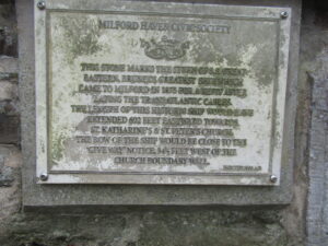
The Sandy Haven area had a strong Baptist religeous following. In the early 1800s a Mr William Lloyd moved to Sandy Haven and services were held in his home. He was a noted herbalist and known locally as ‘Doctor Lloyd’. He provided a piece of land at an annual rental of one shilling for a chapel to be built. This was done in 1814 and the building had a single whitewashed room. It provided a place of worship for the next 60 years for the people of Sandy Haven and Herbrandston. There are also over 100 graves on the small plot. However crossing over Sandy Haven Pill proved a problem for the inhabitants of Herbrandston. So in 1877, Sir William Davies donated the site for a new chapel at Sandy Hill, two miles along the side of Sandy Haven Pill. Much of the site preparation work was carried out by the members of the congregation led by their minister the Rev. William Harries. The total cost was £681 17s 1d. This site remains in use today. The old chapel is now a roofless ivy clad ruin immediately opposite the main gate to The Anchorage.
The modern history of the hamlet of ‘lower’ Sandy Haven with no more than 5 houses on the shingle beach on the west side of Sandy Haven Pill begins with the arrival of Captain Jacob Beer and his son Harry. The story is still told today of how Captain Jacob Beer sailed into Sandy Haven pill and took a liking to its shelter. He was married and he and his wife each owned six trading schooners. His wife refused to join him at Sandy Haven so he remarried a local girl. Captain Beer built Rock House overlooking the tidal pill as well as the stone quay to bring his ships alongside at high tide for unloading their cargoes of wheat, culm and lime. The lime was burned with the culm in the Sandy Haven lime kiln (well preserve today). The lime kiln was owned and operate by a number of £1 share holders including Henry Jenkins the village shoemaker.
Harry Beer became Captain Harry Beer and continued to reside at Rock House. He married and had four children – Henry, Ralph, George and a daughter Grace who were raised at Sandy Haven. Captain Harry operated several sailing ketches that traded around the coast of Pembrokeshire. The culm was transported from Hook and Bonville’s Court collieries and the limestone from the tidal quarries at Carew in ‘The Crystal’ owned by Captain Beer and ‘The Garlandstone’ owned by Captain John Russan. For owners without a quay, the ships were unloaded by horse and cart from the sand banks of the tidal pill. The culm was weighed on the scales still preserved alongside the Sandy Haven lime kiln. It was then taken by horse and cart around St. Ishmael’s village and the local farms where it was mixed with clay to make culm balls that burned long and slowly giving out a good heat. The local coal merchant was Mr. Thomas Davies of The Windmill, Dale.
The local weigh bridge was also used for weighing cattle before they were sold to butchers. In the late 1920’s, Captain Beer bought out the other share holders in the two ships ‘New Foundland’ and ‘New Providence’. He was the last man to burn lime in the Sandy Haven kiln.
In 1982 I flew to Jersey in the Channel Islands and met Henry Millard Beer, a son of Captain Harry Beer who was living there with his wife. I purchased from him a plot of land with a ruined pair of cottages that became The Anchorage, Sandy Haven. At the time the only inhabitant of Sandy Haven was 93 year old Mrs Beer (wife of Captain Harry) who lived alone in Rock House. I got to know her and her four children. She told me a sad story about Captain Harry Beer. In 1928 a schooner ‘The Alice Williams’ was wrecked on Skokholm Island that had been rented for farming in 1927 by Ronald Lockley and his wife. He wrote a series of books on island life that became well known (including: Dream Island, 1938; Island days, 1934; I know an island, 1938) and established the first wild bird observatory in the UK on the island in 1933. He went on to do many things (including a role in forming the coast path around Pembrokeshire) and become well know internationally. He purchased the wreck of the Alice Williams for £5 and needed help to recover the coal cargo and timbers before she broke up in stormy weather. One day he sailed into Sandy Haven pill and asked Captain Harry Beer to help him with the salvage. Help was given, but one day Captain Harry tripped and fell into the hold of the wreck and banged his head very hard. Ronald Lockey brought him home. Mrs Beer said that he must have been hurt badly as he never worked again, but only sat quietly by the side of the fire until he died a few years later. She was bitter that Ronald Lockley had never tried to help her and her four children.
Next door to Rock House was a famous public house known as The Sloop Inn – well known for its cold beers in the heat of summer, as the kegs were stored in a stone basement. The Sloop was owned and operated by George and Annie Hooper. George also operated a ferry across Sandy Haven Pill, so that people could get to and from Herbrandston at all states of the tide. But when George died the ferry operation ceased. Later the pub was owned and run by a Mr and Mrs McGrail and was a popular spot throughout the Second Word War with local farm workers. The pub closed around 1960 because cars became common and there was no room for car parking at The Sloop Inn. Alongside Rock House was Sloop Cottage and next to that Harbour House. On the opposite side of the small beach was another house known as “The House on the Bank”. This was knocked down and replaced by a modern home.
The children of Captain Harry Beer became well known locally. The eldest Henry Millard Beer farmed both Sandy Haven and Skerryback farms and prospered in the 1960s in the boom early potato crop. At one time he owned all the houses at Sandy Haven except for his mothers home of Rock House and he moved to the Channel Islands as a tax exile. The 640 acre Sandy Haven Farm was bought by the Geest Company in 1984 and has since been broken up and sold again. Ralph Beer became a local business man. George Beer also worked on the local farms. Daughter Grace married a local auctioneer and estate agent and became well known as the artist Grace Scurlock. She painted many scenes of Sandy Haven and the Milford Haven Waterway area.
She and her brothers would reminisce on their childhood at Rock House in Sandy Haven. She recalled that in those days there was no electricity, so candles and paraffin lamps were used. There was no piped water and drinking water was obtained from a well nearby or from a spring on the opposite side of the pill accessed at high tide by boat. Captain Harry used to grow the family vegetables in a garden on the clifftop above Rock House. He would fertilise the ground using seaweed gathered from the pill. The children did not like this work as their father had built a derrick on the cliff top to haul up baskets of sea weed.
Grace was very interested in the painter Graham Sutherland. She was a girl when he first came with his wife to Rock House looking for lodgings. He lodged in the cottage of farm worker Sydney Owens who worked at Sandy Haven Farm and stored his paintings in Captain Harry’s shed on the quay. Young Grace and her mother would go and look at the paintings and Mrs Beer did not like them as they were more impressionist than factual. Local people were astonished that Mrs Sutherland wore trousers – something not seen before in the area. Their cottage had no running water, oil lamps, an outside wc, no bathroom, it was necessary to saw logs for the fire and it was a 2 mile walk to the local church at Sandy Hill. I think this cottage was one of the ruined pair that I demolished in 1983 because the door heights came up to my shoulders only. Graham Sutherland, who suffered from arthritis, liked very much the warm shelter of Sandy Haven Pill and was fascinated by the colours and shapes in the area. He painted the laid-up wreck of ‘The Crystal’ and made many paintings of the Sandy Haven area. He also made a film of Sandy Haven. On the cover of his autobiography, he showed the laid-up wreck of one of Captain Harry’s ships – ‘The Cornish Lass’.
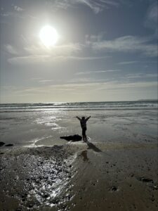
In the third millennium, the character of Sandy Haven community is changing. Sandy Haven House is still the centre of Sandy Haven Farm. But the small community of lower Sandy Haven is changing as the old cottages of the farm workers are being purchased by elderly successful career people (needing a quiet retreat or retirement) and being knocked down and replaced by modern homes. As the hamlet is in the National Park, no new buildings are permitted, so that new buildings must replace old buildings and also retain the character of the area. The old ‘Upstairs and Downstairs’ division has disappeared. Today with abundant motor cars, the sands of Sandy Haven has become a popular tourist destination and it is not unusual to hear European languages being spoken by family groups playing on the sands. The Anchorage has been booked by German and Dutch groups for summer holidays. There are two popular Sandy Haven beaches that cause some confusion to tourists as both are signposted “Sandy Haven”, but on either side of the tidal pill. The hard beach on the west side of the pill at Lower Sandy Haven hamlet, is today a popular turning place for cars and for launching sail and motor boats when the tidal pill fills with sea water. At low tide the footbridge across the pill is often crowded with families with children, as catching crabs there is very popular. On the eastern side of the pill, the sandy beach of Sandy Haven (accessible through Herbrandston village) is also very popular as being the nearest sandy beach to the town of Milford Haven. It has a car park, camping ground, toilets and a caravan park. Many people bring their dogs to the beach for long walks on the extensive sand area at low tide.
Lindsway Bay 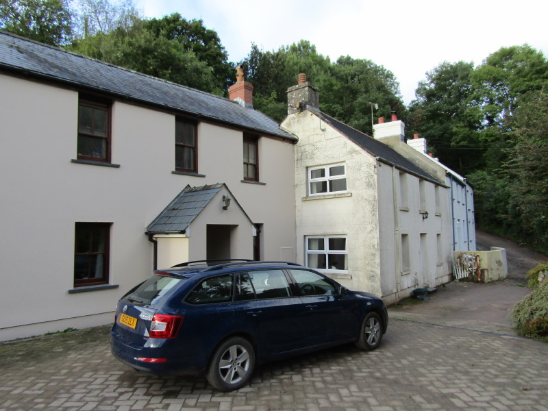
Lower Sandy Haven 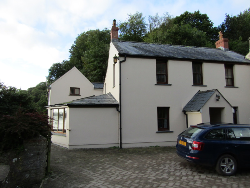
Lower Sandy Haven 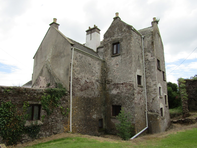
Rear view of Sandy Haven House 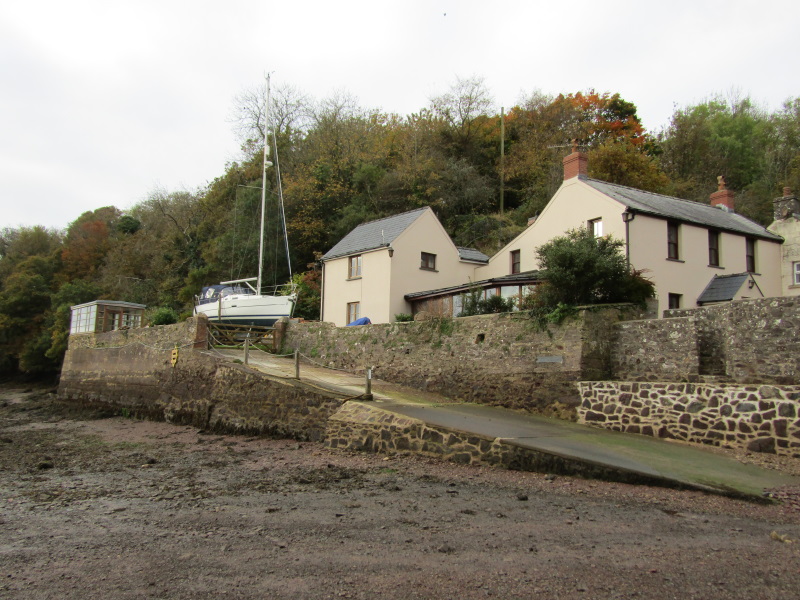
Rock House Lower Sandy Haven 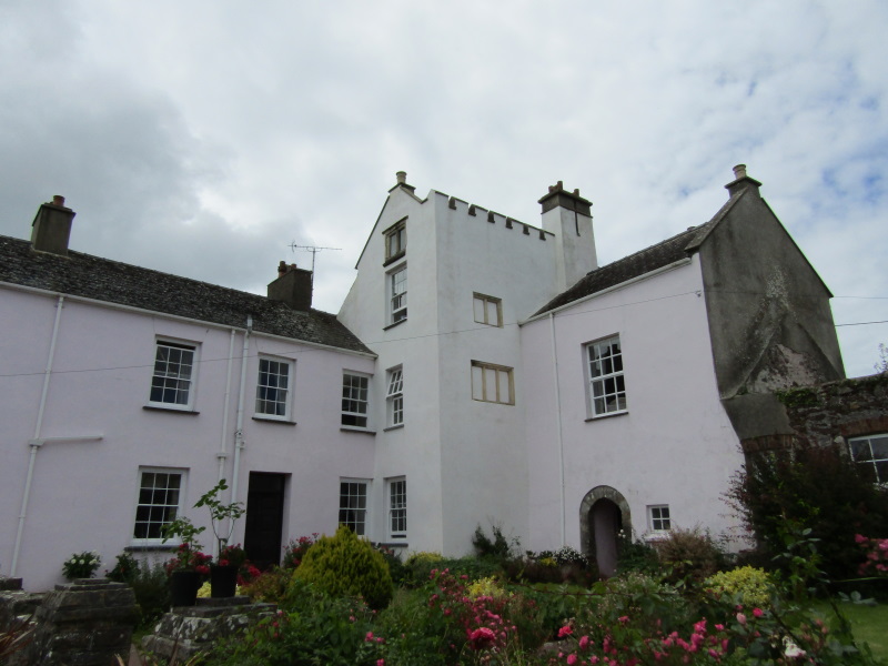
Sandy Haven House with central tower house 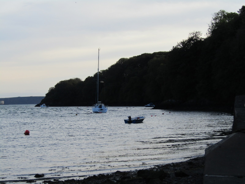
Sheltered moorings at Sandy Haven 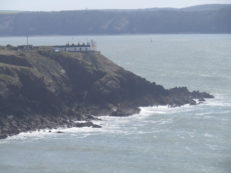
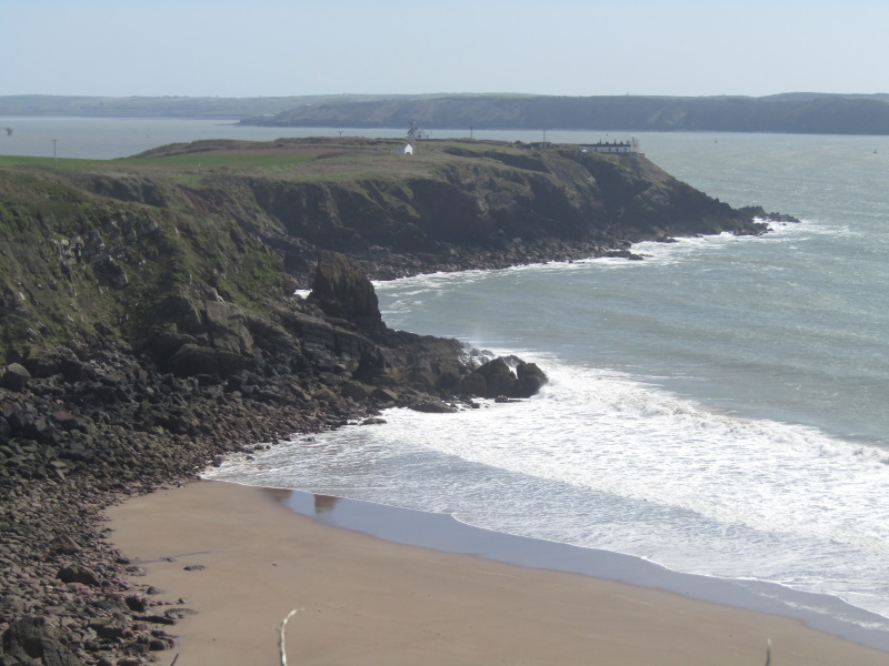
The former lighthouse on Great Castle Head Lindsway Bay 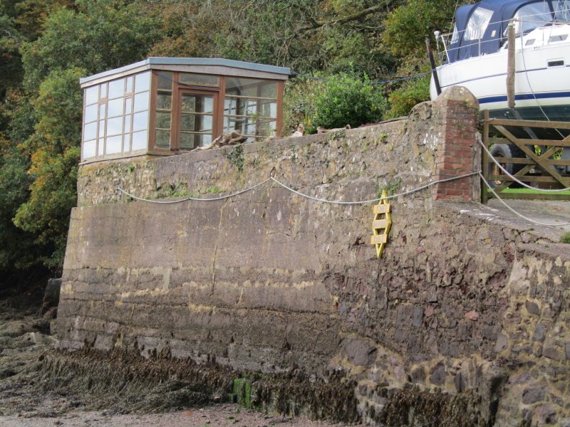
The gazebo at Rock House where Grace Surlock painted 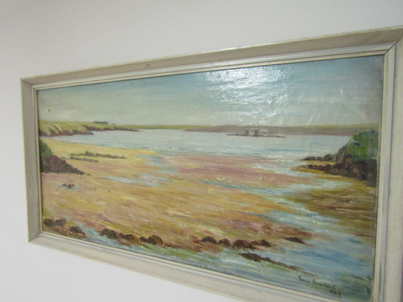
The sands of Sandy Haven Grace Scurlok 1962 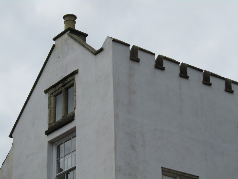
Top of the Tower House